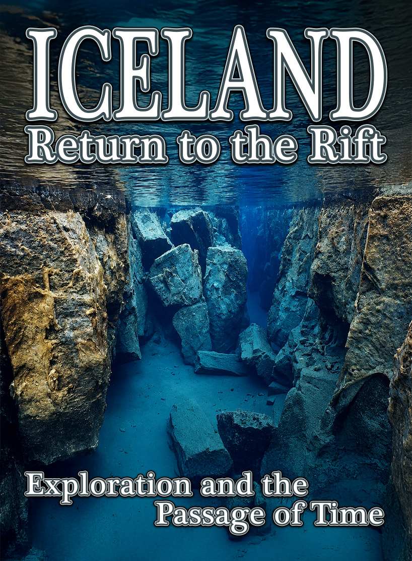
Iceland - Return to the Rift: Exploration and the Passage of Time – Part I
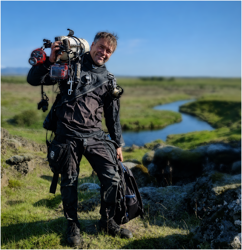
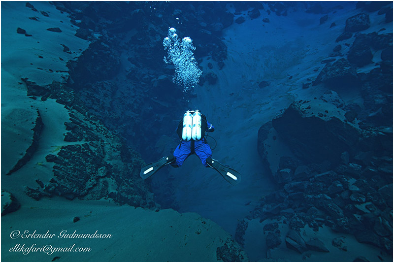
Copyright, Erlendur Gudmundsson
By Bernie Chowdhury
My Track
0:000:00
🔊
Audio Player: Let ADM read the editorial for you.
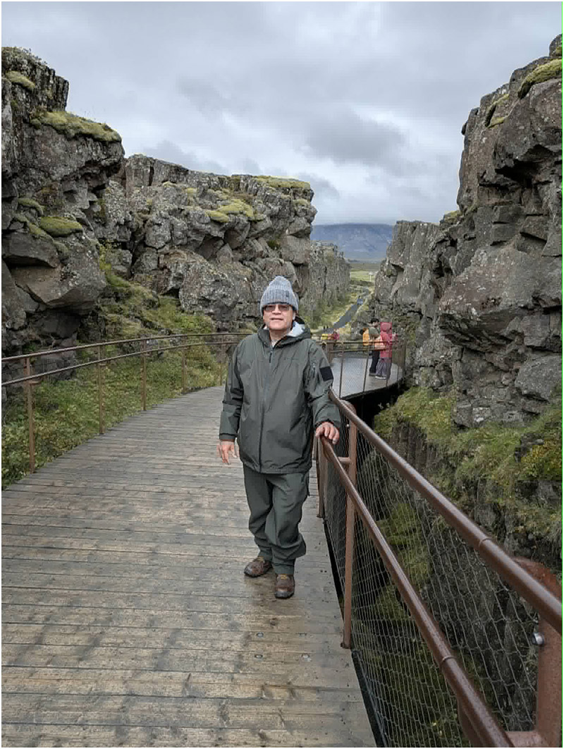
Bernie Chowdhury inside the surface rift at Thingvellir National Park.
Copyright 2025, Bernie Chowdhury
September 2025
I walked quickly, almost urgently, toward Silfruhellir -- formerly known as Silfur Hellir -- the Silver Cave -- in Iceland's Thingvellir National Park.
Excitement drove me forward, but it was tempered by something else: reflection.
Much had happened here. Much had changed. That is the nature of time.
One of the changes impacted the very cave that I had explored here over many years, starting in 1995. What I had known as Silfur Hellir – two words -- was now officially called SILFRUHELLIR – one word -- because of Icelandic naming conventions. The country adheres to strict language rules and maintains the same language as the 10th Century Norse Sagas were written in. Even words for new things, such as computer, have to align with traditional Icelandic language naming. If you know modern Icelandic, you can read the great works of Norse literature in their original, without any translation!
In Iceland—and especially at Thingvellir— time seems to operate on a different scale. The forces that created this extraordinary landscape are still at work today, reshaping it in ways we are only beginning to understand.
Beneath my feet, two immense slabs of the Earth's crust—the North American and Eurasian tectonic plates—continue their slow separation. Their relentless movement tears apart ancient lava rock, creating fissures and caves, including Silfruhellir and the famous Silfra Rift, which extends beyond the cave and into Thingvallavatn, Iceland's largest lake.
I understood all of that now.
I did not understand it when I first arrived in Iceland in 1995.
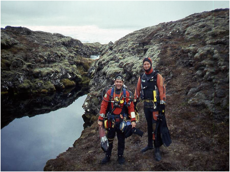
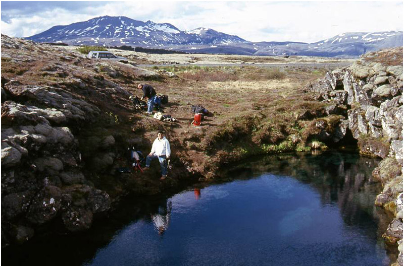
Bernie Chowdhury (L) and Icelandic guide, explorer, and commercial diver Erlendur “Elli” Gudmundsson, ready for their first dives at the Silfra Rift. The Sifruhellir Pool (formerly, The Silfur Hellir Pool) is on the left. Copyright 1995, Thomas Easop.
Above: Bernie Chowdhury Decompressing in Silfruhellir Pool (formerly Silfur Hellir Pool) after a dive to the end of the cave at 197 feet / 60 meters. Copyright 1995, Thomas Easop.
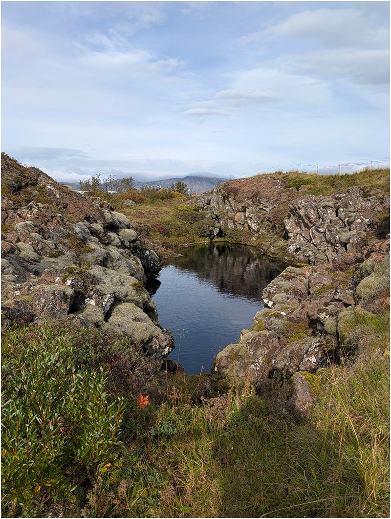
Thingvellir National Park, Iceland. The tectonic plates of Eurasia and North America are rifting surface lava rock asunder, as clearly seen in this image. This powerful geologic force is responsible for the formation of Silfruhellir (formerly, Silfur Hellir) and the Silfra Rift. Copyright 2025, Bernie Chowdhury
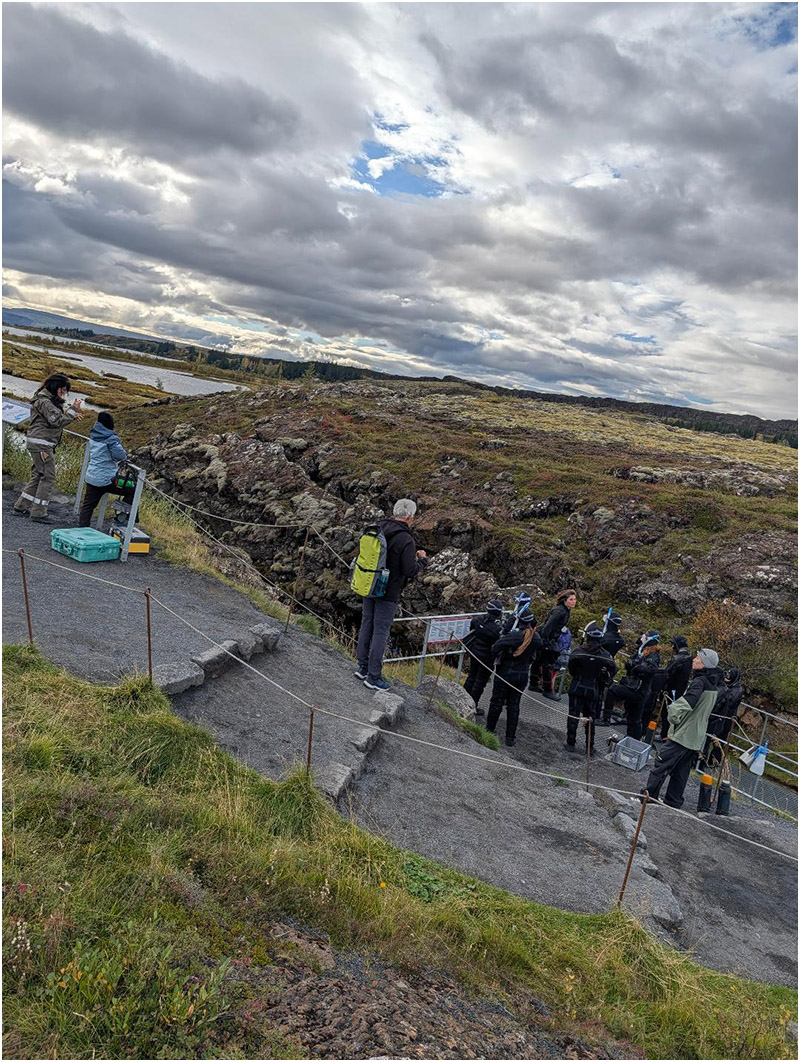
Divers prepare to enter the Silfra Rift from this aluminum platform and stairs. Iceland’s largest lake, Thingvallavatn, is in the background, upper left. This platform did not exist in 1995, when author and explorer Bernie Chowdhury first went to Iceland to investigate the diving possibilities. In 2024, 80,000 divers and snorkelers are reported to have experienced the Silfra Rift.
Source: Einar Asgeir Saemundsen, Director of Thingvellir National Park.
Copyright 2025, Bernie Chowdhury
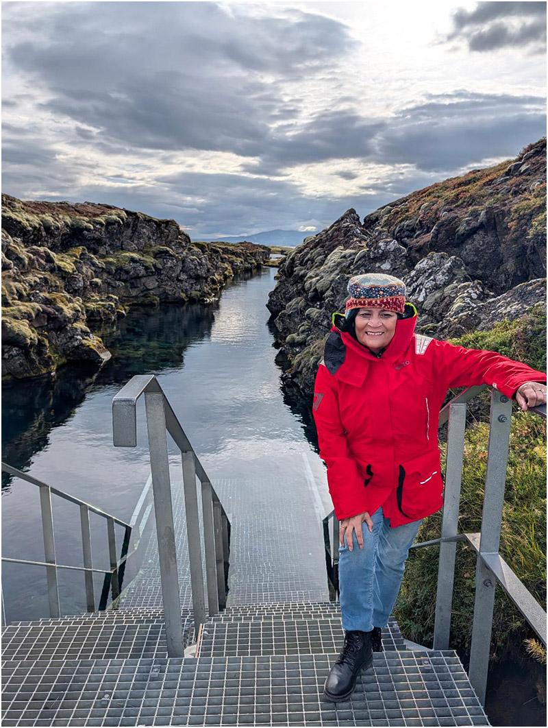
Dr. Nasreen S. Haque, Ph.D. stands on the aluminum diver staging platform at the Silfra Rift in Thingvellir National Park, Iceland.
Dr. Haque is a molecular and cellular biologist. She was the scientist on the Iceland Expedition 2025, whose primary objectives were biological in nature: the Team would collect bio-samples – with the written permission of the Icelandic government – and analyze them for two things, including whether microbes (things too small to see without a microscope) in the bio-samples could be useful in human medicine; and, determining how different microbes organized themselves within their environment, and if that could be a useful marker to determine the relative health of the environment on the day that the bio-samples were collected. The latter is known as “multi-fractal analysis”. This Expedition was the first to conduct this type of analysis during actual field exploration.
Copyright 2025, Bernie Chowdhury.
Before returning to Iceland in 2025, I was warned that Thingvellir National Park was very different from the place I had explored in 1995-1997.
Einar Asgeir Sæmundsen, Director of Thingvellir National Park, told me that a substantial diving tourism industry had taken root since my last visit. In 2024, he said, 80,000 divers and snorkelers experienced the Silfra Rift.
That's not a typo: eighty thousand divers.
He went on to explain that those divers and snorkelers contributed approximately US $1 million annually to Iceland's economy. While I am sure that additional revenue is welcome, I struggled to comprehend what daily traffic amounting to 80,000 divers and snorkelers each year would actually look like at this UNESCO World Heritage Site.
I hesitated to imagine the infrastructure required to support that many visiting divers.
Even the walk toward Silfruhellir and the Silfra Rift was different.
When I first came to Iceland in 1995, very few divers visited Thingvellir National Park. Iceland itself also received far fewer tourists than it does today.
Above: In 1995, Bernie Chowdhury gets ready to dive at SilfruHellir Pool (formerly Silfur Hellir Pool). The entrance to Silfruhellir (formerly Silfur Hellir – The Silver Cave) is seen on the right-hand side, middle of frame, and is distinguished with a triangular shaped rock opening.
Copyright 1995, Thomas Easop.
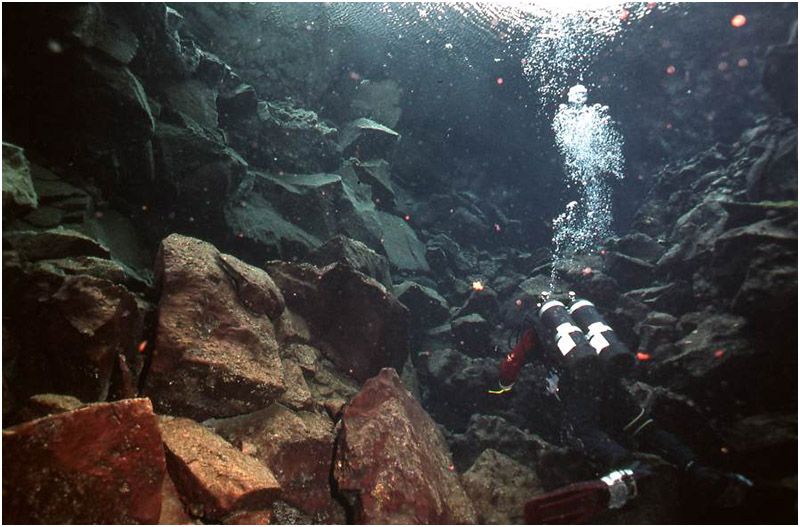
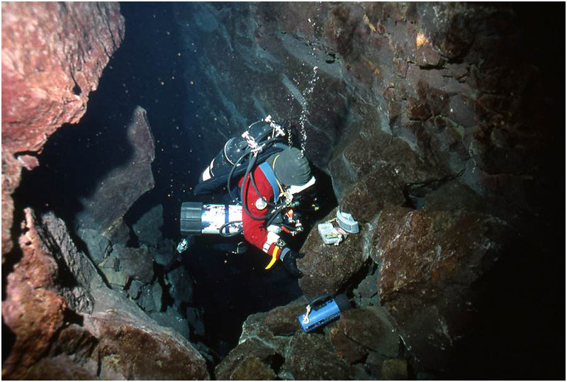
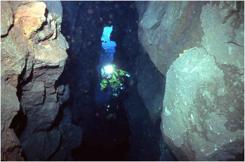
Below: Inside Silfruhellir (formerly Silfur Hellir Cave): Prepping the Push. Bernie Chowdhury sets up his gear underwater before making the push dive to the end of this spring system cave, at 197 feet / 60 meters depth. The cave is formed as a direct result of the tectonic plates of Eurasia and North America rifting apart each year. It is the World’s only known diveable cave directly formed by this geologic phenomenon. On the Iceland Expedition 2025, the black lava rock walls seen here were brightly lit with the use of an ROV (Remotely Operated Vehicle) and showed these walls to be bright yellow and orange, indicating high sulfur and iron content.
Copyright 1995, Thomas Easop.
The roadway had recently been paved. As I followed the asphalt ribbon through muted gray lava fields, memories came flooding back from my time here and in other northern diving destinations during the mid-1990s. Gray-green lichen clung to the lava rock on either side of the road, softening the harsh volcanic landscape.
Of course, Icelandic divers had always taken advantage of the crystal-clear waters of the Silfra Rift and Thingvallavatn, even in the mid-1990s. But there were not vast numbers of Icelandic divers then, so it was uncommon to encounter anyone else underwater except on weekends.
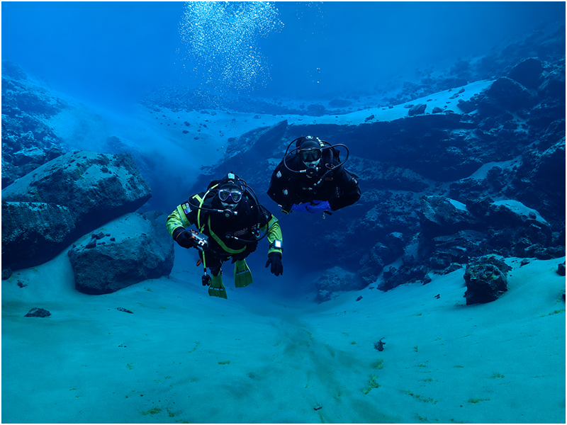
Iceland’s inland underwater landscape is punctuated with crystal-clear, glacial water. Copyright Sigurdur Haraldsson
As I walked, the blacktopped roadway began to climb.
A sign pointed toward SILFRA RIFT.
I looked over my right shoulder toward the area where I knew Silfruhellir lay. Arctic wildflowers bloomed among patches of gray-green lava rock covered with lichens in delicate shades of pale blue and green.
A pool leading to Silfruhellir's entrance, just below the surface, seemed smaller than I remembered.
Silfruhellir Pool (formerly Silfur Hellir Pool) seemed smaller than the author remembered from his explorations in the mid-1990s.
Copyright 2025, Bernie Chowdhury.
As my eyes followed the water from Silfruhellir across what I have always called "Silfur Hellir Pool" (but should properly be called “Silfruhellir Pool”) toward the lava rocks at the far end, an involuntary exclamation escaped my lips—first alarm, then relief.
A sizeable aluminum structure had been built on the rocks opposite the cave.
Upon closer inspection, I could see stairs leading down to a platform. As I moved farther up the incline, I realized that additional steps descended from the platform into the waters of the Silfra Rift.
No steps led into Silfruhellir Pool.
I felt immediate relief.
At least we would not have to contend directly with dive shop operations and guide services bringing paying customers into this unique cave system.
I wondered why it had taken me nearly three decades to return to this remarkable country.
Nature's power, violence, and beauty are on constant display here.
In Iceland, underwater cave exploration remains a relatively new endeavor.
The last time I had stood here was during the Icelandic Cave Diving Expedition of September 1997, a project I organized that carried the prestigious Explorers Club Flag. At the time, it was the most ambitious diving expedition I had ever organized or participated in.
That was saying a lot.
Before Iceland, I had already participated in several groundbreaking deep-wreck expeditions, including the first organized mixed-gas sport-diving expedition to the famed Italian luxury liner Andrea Doria off Nantucket, Massachusetts. I had also taken part in the British Army's Pheasant Hunt Expedition, during which we searched for, found, and dived the missing First World War destroyer HMS Pheasant in 280 feet (85 meters) of water off Scotland.
As with all Expeditions, the most important element is the people involved and how effectively they function as a Team while pursuing difficult objectives.
The Iceland Expeditions of 1997 and 2025 exemplified that principle. Both achieved significant goals because of the individual skills of their members and the combined efforts of the Team as a whole.
The success of the 1997 Icelandic Cave Diving Expedition rested largely on the exceptional divers who joined the Team, even after I was forced to reschedule the project following sponsorship opportunities offered by the Icelandic Tourist Board.
That Expedition produced a historic result.
In 1997, we became the first Team ever to survey and map an underwater cave in Iceland.
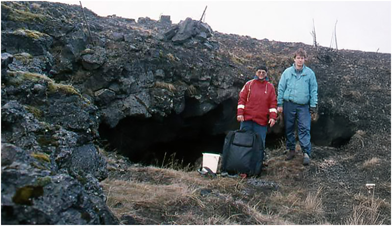
Kerauga Cave Entrance, 1995: Bernie Chowdhury (L) and Icelandic Cave Diver Palmi Dungal stand at the entrance to Kerauga cave, before it collapsed. Palmi Dungal and Erlendur "Elli" Gudmundsson were two Icelandic divers that Steve Berman certified at Full Cave level. Their enthusiastic welcome and hospitality made possible the further exploration of Iceland's cave, which continues today. Palmi had laid line here and made it possible for Bernie to push the system and extend its known length. Further exploration was halted when the entrance collapsed because of geologic activity sometime between 1995 and 1997, when the Icelandic Cave Dive Expedition surveyed and mapped Silfruhellir (formerly Silfur Hellir cave), which is formed by the tectonic plates of Eurasia and North America rifting apart every year.
Copyright 1995, Thomas Easop.
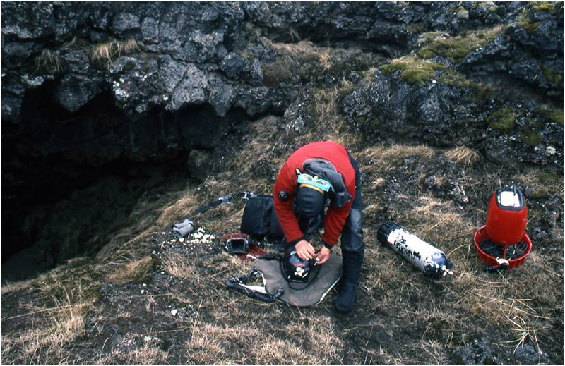
Above: Bernie Chowdhury sets up for dives in Kerauga Cave, which is several hours inland from Silfruhellir (formerly Silfur Hellir Cave) and Thingvellir National Park. After two set up dives to stage a breathing cylinder and a diver propulsion vehicle (a scooter), Bernie was able to push the system and extend the known length by 150 feet after going through a total of three air-filled chambers at the end of a long lava tube. Forward progress in each of the air-filled chambers was painstakingly slow. Later, this system’s entrance collapsed: as a result, the 1997 Icelandic Cave Dive Expedition had to focus its efforts solely on Silfruhellir (formerly Silfur Hellir cave). Copyright 1995, Thomas Easop.
Below: Bernie Chowdhury scampers into the entrance of Kerauga Cave. The water is just behind him. This low entrance required tanks and other equipment to be dragged through the sandy soil and into the waist-high water, where the final equipment donning had to take place. The water temperature is 34 F / 1 C. Copyright 1995, Thomas Easop.
Nearly three decades later, as I prepared for a new Expedition in September 2025, we still remained the only Team to have accomplished that distinction.
For the 1997 Expedition, I assembled not only an excellent diving Team but also a documentary film crew that included Canadian underwater cinematographer Terry German and topside filmmakers from New York City.
Canadian Underwater Cameraman Terry German. Courtesy, Terry German Collection
Our original objective was to document two underwater cave systems formed by very different geological processes.
Nature had other plans.
One of the cave entrances had collapsed, most likely as a result of Iceland's continual earthquakes and volcanic activity.
During my first Icelandic exploration in 1995, I had extended the known length of Kerauga Cave with the assistance of Icelandic divers and my American dive buddy. Kerauga was located several hours inland and east of Silfruhellir.
Sometime between that exploration in 1995 and June 1997—when Terry German and I returned for a reconnaissance trip ahead of the September Expedition—the entrance collapsed.
The new view of Kerauga's entrance revealed exactly where a large horizontal rock ledge had broken away and fallen. Looking into the pool below, we could clearly see massive boulders blocking access to the underwater cave.
It was a stark reminder that exploration in Iceland takes place within a landscape that is still very much alive.
Kerauga had fascinated me when I first saw it.
Now it captivated me.
At the same time, I shuddered to think that the collapse could easily have occurred while I—or another diver—was inside the cave.
Above: Kerauga Cave Entrance Collapse.
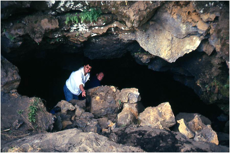
Bernie Chowdhury and Erlendur “Elli” Gudmundsson (further inside) examine the fresh breakdown of Kerauga’s entrance during the June 1997 reconnaissance trip prior to the September 1997 Icelandic Cave Dive Expedition and documentary filming.
It wasn’t until Sigurdur “Siggi” Johann Haraldsson’s Under the Lava Expedition in 2024 that this cave was again explored. Siggi and his Team were able to remove the boulders blocking the entrance; they greatly extended the known length of this system, including more underwater passageway, and dry passages.
This cave’s entrance has collapsed multiple times and is highly unstable. Further exploration is on hold until another -- more stable -- entrance can be found. Copyright 1997, Terry German.
When I explored Kerauga Cave in 1995, it consisted of a lava tube leading into a series of partially air-filled chambers littered with enormous breakdown boulders. Suspended from the ceilings were rectangular slabs of lava that looked like stone daggers poised to fall at any moment.
Each of the three chambers was characterized by extremely slow water movement, a sharp contrast to the powerful spring flow that had to be overcome to reach them.
Fortunately, I had been able to borrow what was believed to be Iceland's only diver propulsion vehicle—a scooter—which proved essential in fighting the current.
Inside the breakdown chambers, it was extraordinarily difficult to determine where the water flowed or where further exploration might continue. Progress was painstakingly slow.
I passed through three such chambers and added approximately 150 feet / 46 meters of new guideline to the known extent of the cave.
One hundred fifty feet may not sound like much.
In a large, warm-water cave system, it isn't.
But in water measuring only 34°F (1°C), covering an additional 150 feet / 46 meters can require enough time underwater to become life-threatening without adequate thermal protection.
I wore a drysuit to keep the glacial water off my skin. Beneath it were three separate layers of insulation, including an undergarment that resembled a ski suit.
It kept me alive.
Not comfortable.
Not warm.
Alive.
By the time I made the push dive, I was already deeply chilled from the two setup dives required to make it possible.
At the beginning of the project, I had to force both the borrowed scooter and an additional breathing cylinder through a restriction. The gap between a large boulder and the smaller lava rocks beneath it was so tight that I had to excavate space with my hands and forearms before I could squeeze through into the spacious lava tube beyond.
The restriction also prevented me from wearing back-mounted double tanks. Only a single cylinder would fit through. Unless I wanted to bring a shovel and dig a deeper passage, my second tank had to be clipped beneath my arm in stage configuration.
Eventually, at the furthest known point in Kerauga Cave, I reached the limit of what my body could tolerate.
There, beneath one of the immense dagger-like slabs hanging overhead, I secured my guideline to a lava rock.
The other end was tied to a line previously laid by Icelandic diver Palmi Dungal. As he had requested, I left his guideline reel beside the line so I could retrieve it during my exit.
By then, I had already spent more than two and a half hours underwater.
I knew I needed to leave immediately if I wanted to avoid true hypothermia rather than the violent, uncontrollable shivering that had already begun.
By the end of the day, I had spent approximately three hours immersed in 34°F (1°C) water.
I could not have completed the dive without my American dive buddy, Tom Easop, or Icelandic divers Erlendur "Elli" Gudmundsson and Palmi Dungal.
At the start of the exploration, Tom helped me don my equipment while we stood in a chamber with icy water up to my waist.
During the long exit, I found myself repeatedly thinking about that entrance chamber and the simple comfort of knowing Tom would be waiting there to help remove my equipment so I could reach the warmth of a vehicle before the cold became overwhelming.
That 1995 exploration led to additional work in 1996 with Elli and Palmi and ultimately to the organization of an Expedition involving divers far more skilled than myself.
For the 1997 Expedition, our attention focused on Iceland's most geologically significant underwater cave: Silfruhellir, formed by the ongoing separation of the North American and Eurasian tectonic plates.
The cave descends to a depth of 197 feet / 60 meters.
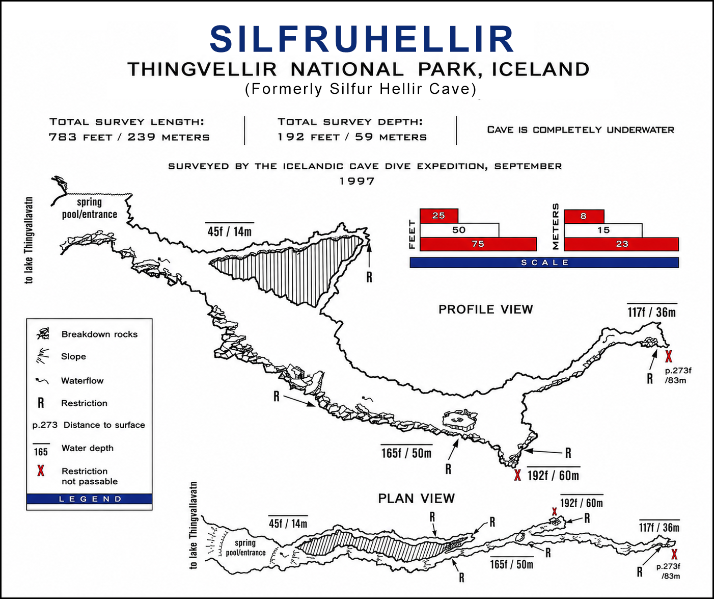
Canadian diver Kim Martin and American cave-diving instructor Steve Berman completed the survey work. Berman subsequently produced the first underwater cave map ever created in Iceland.
Canadian underwater cinematographer Terry German documented the Expedition on film.
Icelanders Elli Gudmundsson and Palmi Dungal proved invaluable, providing logistics support and the local knowledge so critical to any successful exploration project.
My role was to organize the Expedition and keep it moving forward—a task that required solving a steady stream of problems with the help of Team members, Icelandic divers, and the New York-based film crew.
And there were plenty of problems.
Two brand-new portable compressors that I had shipped to Iceland failed within ten hours of operation despite meticulous adherence to the manufacturer's break-in procedures and oil-change schedules.
Fortunately, Kim Martin and one member of the New York film crew both had extensive experience racing snowmobiles and motorcycles. After troubleshooting the failures, they determined that different components had failed in each machine.
Replacement parts were immediately ordered from the United States.
Meanwhile, the two men worked through the night, stripping both compressors down and rebuilding a single functioning unit from the surviving parts.
It was fortunate that they succeeded.
The replacement components did not arrive in Iceland until well after the Expedition had ended.
There is a simple lesson in Expedition leadership: assume things will go wrong.
Fortunately, I had arranged a backup plan before leaving home.
Villi Halgrimsson, President of the Dive Club of Reykjavík, had agreed to let us use the club's large compressor if necessary. Naturally, club members took priority and our Team came second. We understood completely and remained grateful when our turn finally came to use the high-capacity system.
The backup plan worked perfectly.
When the portable compressors failed, access to the Dive Club's compressor prevented us from losing any diving time.
Without the support of Icelandic divers, our Expedition would have accomplished very little.
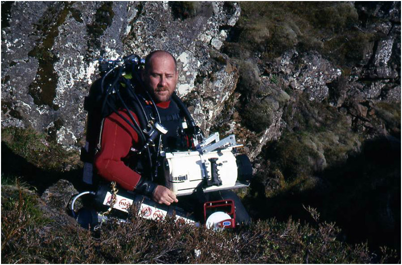
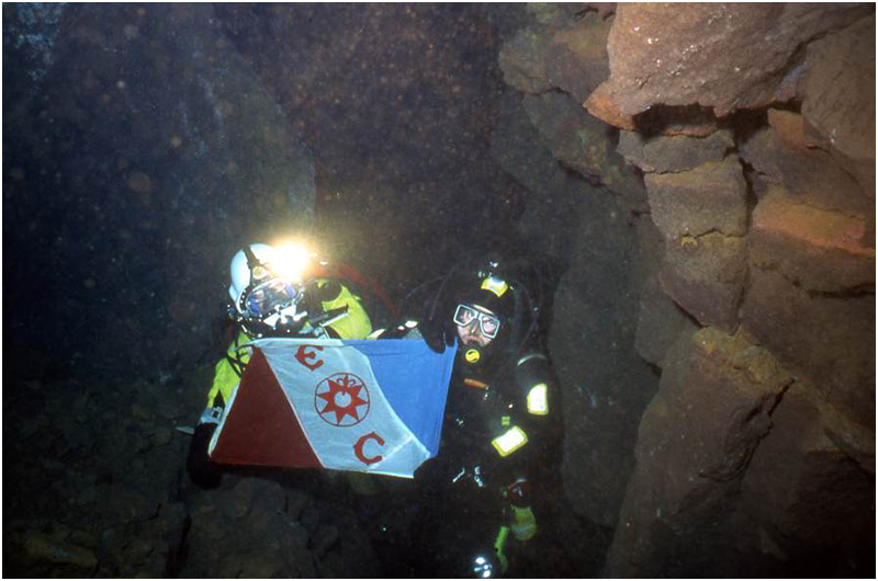
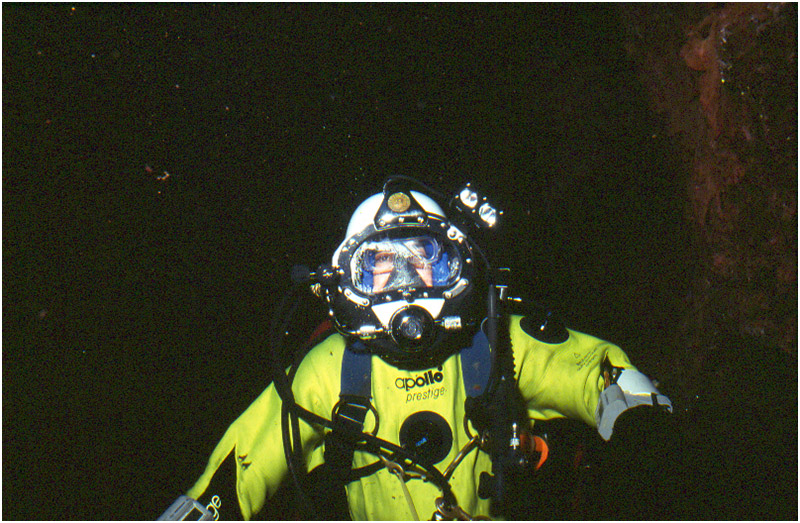
Bernie Chowdhury (L) and Villi Halgrimsson with Explorers Club Flag #193, inside Silfruhellir (formerly Silfur Hellir), a cave formed by the tectonic plates of Eurasia and North America rifting apart every year. It is the World’s only known diveable cave formed as a direct result of this geologic phenomenon. Bernie used a commercial diving helmet adopted for use with scuba because of a ruptured ear drum. After the Expedition, surgery resolved the issue and he was able to go back to using standard scuba masks. Copyright 1997, Erlendur Gudmundsson.
In September 1997, cave diving instructor Steve Berman and Kim Martin explored the Silfra Rift, the famous fissure formed where the Eurasian and North American tectonic plates continue to drift apart. During the expedition, Berman and Martin conducted an underwater survey of Silfruhellir (formerly Silfur Hellir cave). Later, Berman produced a detailed map using the collected data. As of June 2026, his surveyed map of Silfruhellir (formerly Silfur Hellir Cave) remains the only completed, published underwater cave map of any Icelandic cave system.
Tragically, in May 2001, Berman was found dead in Florida's Devil's Cave System. He was carrying the final survey data needed to complete a comprehensive map of the extensive limestone cave network, the culmination of more than ten years of exploration and surveying. Following his death, fellow cave divers used his records to complete and publish the full surveyed map of the Devil's Cave System, ensuring that his final project and legacy would endure.
Bernie Chowdhury Collection.
My Icelandic explorations—and my fascination with the country—began during the winter of 1994 with a casual conversation between cave dives in north-central Florida.
I was diving with cave instructor Steve Berman, who taught at Ginnie Springs, a short drive north of Gainesville.
I had earned my Full Cave certification in 1989 and had become friends with several instructors and staff members at Ginnie Springs. Steve and I had developed a solid friendship during a wreck-diving trip I organized to North Carolina and later during Andrea Doria dives in the summer of 1990, when we were able to recover artifacts on only our second dive on the wreck.
Dishes from the Andrea Doria
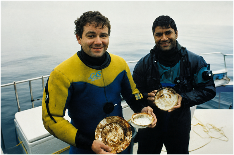
Cave diving instructor Steve Berman (L) and Bernie Chowdhury hold dishes recovered from their second dive on the famed Italian luxury liner Andrea Doria, off Nantucket, Rhode Island, USA. Berman was the inspiration for Iceland cave diving explorations in 1995 and 1996, and the 1997 Icelandic Cave Dive Expedition, during which he and Kim Martin surveyed Silfruhellir (formerly Silfur Hellir Cave) in Iceland’s Thingvellir National Park. His map of the cave is – as of June 2026 – still the only one of any of Iceland’s underwater caves. Courtesy Capt. Hank Garvin, 1990.
Steve Berman was also an important member of the Team Doria '91 Expedition that I organized, which incorporated mixed gases and several newly developed proprietary dive tables.
In 1991, very few non-commercial or non-military divers were using helium-based breathing mixtures. The dive tables for such dives were closely guarded by small groups of explorers who were typically engaged in specific projects or searching for worthy expeditions to join.
Between cave dives in Florida during the winter of 1994, Steve mentioned that he had recently certified two men from Iceland as Full Cave divers.
Immediately, I saw the possibilities.
"Iceland! Man, that's got to have some cool diving. Let's go!"
"Naw," Steve replied in his usual laconic manner. "I'm too busy teaching. You go and see what's there."
That brief exchange launched years of exploration by me and other non-Icelandic divers, enthusiastically supported by Steve's Icelandic students, Erlendur "Elli" Gudmundsson and Palmi Dungal.
As of June 2026, that casual conversation with Steve Berman had led to two Explorers Club Flag Expeditions, with at least two more planned for the coming years.
Unfortunately, time has not been kind to Steve Berman or Kim Martin.
Berman died in May 2001 at the far reaches of the Devil's Cave System at Ginnie Springs.
For ten years, he had worked to gather survey data throughout that extensive cave system. On his final dive, he carried the last survey information needed to complete a map of the cave. The data were recorded on a white plastic slate clipped to his person.
Steve dove alone, as he often did.
Reportedly, he had accumulated more than 10,000 dives, including approximately 1,500 within that cave system alone.
He was found with no breathing gas remaining in his large, gray, back-mounted double tanks.
One hand still formed an OK sign around the white guideline leading into and out of the cave.
About 150 feet / 46 meters farther along the exit route lay a reserve cylinder clipped to the guideline, along with a scooter that he had staged for his exit—or for an emergency.
There was no sign of a struggle.
No indication that he had encountered a significant problem.
We do not know exactly what happened on Steve's final dive because he was alone.
The autopsy revealed a partial blockage of a major coronary artery, commonly referred to as a "widow maker."
Perhaps he suffered a cardiac event.
Steve Berman was the last person I would have expected to die underwater.
His death remains one of the most difficult losses among all the divers I have known who died beneath the surface.
Kim Martin (above) and Steve Berman surveyed Silfruhellir (formerly Silfur Hellir Cave) in 1997. Steve Berman created the detailed cave map based on the survey notes captured by both divers.
In August 2019, Kim was paralyzed after a dive on RMS Lusitania, off the coast of southern Ireland.
During the Iceland Expedition 2025, Kim was able to continue exploration in Iceland from his apartment in Canada using a remotely operated vehicle (ROV), thanks to the tireless efforts of Icelandic divers Sigurdur "Siggi" Haraldsson, Birgir "Biggie" Skulason, and Johannes Thormordsson who overcame numerous technological challenges to make the remote connection possible. Copyright 2024, Bernie Chowdhury.
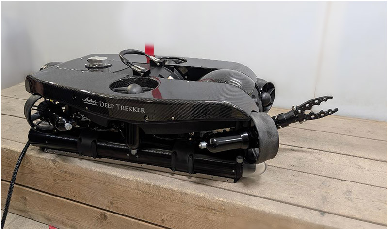
The Deep Trekker Revolution Reconn Remotely Operated Vehicle (ROV) used by Iceland Expedition 2025. Kim Martin was able to connect to the ROV in Iceland from his apartment in Canada, thanks to the persistence and sheer willpower of Icelandic divers Sigurdur "Siggi" Haraldsson, Birgir "Biggie" Skulason, and Johannes Thormordsson. Copyright 2024, Bernie Chowdhury.
In August 2019, Kim Martin—the same diver who had surveyed Silfruhellir with Steve Berman—was paralyzed following a dive on RMS Lusitania off the southern coast of Ireland.
The wreck rests in 325 feet / 99 meters of water.
Of course, it was impossible to bring Steve Berman on the September 2025 Expedition.
Technology, however, would allow Kim Martin to continue exploring, albeit remotely.
In what may have been a first in underwater exploration, Kim piloted a remotely operated vehicle from his wheelchair in an apartment in Toronto, Ontario, while collecting data for the mapping of the Silfra Rift in Iceland.
That achievement was made possible by a group of Icelandic divers who worked tirelessly—and at times heroically—to overcome the frustrations of establishing a reliable connection between Iceland and Canada.
Sigurdur "Siggi" Haraldsson, Birgir "Biggie" Skulason, and Johannes Thormordsson refused to quit.
Even after exhausting what seemed like every possible solution multiple times, they continued troubleshooting.
Ultimately, they succeeded through persistence, ingenuity, and sheer Icelandic willpower.
Sigurdur "Siggi" Haraldsson led the Under the Lava 2024 Expedition to extend the known length of Kerauga Cave. In the mid-1990s, Icelandic cave diver Palmi Dungal first laid line here, and then Bernie Chowdhury extended the length of the cave on separate dives. In 2024, Siggi painstakingly removed very heavy boulders that had collapsed and sealed the entrance of Kerauga cave so that he and his Team could explore further. The cave collapsed two more times. Each time, Siggi cleared the entrance and carried on.
The cave's instability dictates caution; for now, exploration at this site is on hold, pending the discovery of another -- safer and more stable -- entrance. Courtesy, Sigurdur Haraldsson Collection
If Steve Berman sparked my passion for Icelandic exploration in 1994, it was Icelandic cave diver and tech diving instructor Sigurdur "Siggi" Haraldsson who reignited it during the winter of 2024.
Siggi told me that his Under the Lava Expedition had successfully regained access to Kerauga Cave. Not only had his Team extended the known length of the cave considerably, they had also discovered additional dry passage beyond the underwater sections.
I was astonished.
When I asked how he had accomplished it, Siggi sent a video.
In it, he painstakingly removed boulders from Kerauga's entrance using a come-along—a simple hand-operated mechanical device that slowly tightens a strap around an object and pulls it forward through repeated movements of a lever.
The process was brutally labor-intensive.
Siggi estimated that each boulder weighed between 60 and 80 kilograms (132 to 176 pounds).
What struck me most during our correspondence—aside from Siggi's determination—was how unstable Kerauga truly was.
The entrance had collapsed twice more since my last visit.
Each time, Siggi removed the boulders blocking the passage so that he and his Team could continue their exploration.
I reminded him that such an unstable cave system could eventually trap divers inside, likely resulting in fatalities.
He agreed.
Eventually, both of us concluded that further exploration through that entrance was difficult to justify.
Perhaps another route into Kerauga will one day be found.
Even then, the danger remains.
The enormous boulders hanging from the cave ceiling could collapse while divers are inside.
Siggi's news, along with the photographs and videos he shared, rekindled my desire to continue exploring in Iceland.
Even though I had developed avascular necrosis with a bone island in my left hip—and could not scuba dive again until after hip-replacement surgery—I knew technology could help us continue the work.
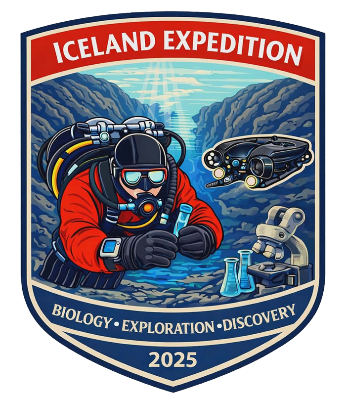
Official logo for Iceland Expedition 2025.
The motto, "Ever Onward," originated naturally as the team overcame one obstacle after another throughout the expedition. Through exceptional teamwork, they achieved a successful expedition and accomplished several new "firsts" in field exploration.
Iceland Expedition 2025 – Ever Onward!
Despite the physical injury that prevented me from diving, I was not going to let that stop me from organizing another Expedition.
I had adapted and overcome before.
I would do it again for Iceland Expedition 2025.
In 1997, I pushed ahead with the Icelandic Cave Diving Expedition despite a serious ear injury that required surgery before I could safely resume standard scuba diving.
Just before the planned September 1997 Expedition, I had been invited and authorized by the British Army to participate in its Pheasant Hunt Expedition. The objective was to locate and dive HMS Pheasant, a missing World War I destroyer that had mysteriously vanished from its anchorage at Scapa Flow in Scotland’s Orkney Islands without so much as a radio message signaling its departure.
Although I was not in the British Army and had never served in any military, I knew Scapa Flow and the Orkneys well. I had often dived the wrecks of the German High Seas Fleet there and had arranged group dive trips to this remarkable site.
As a result, I had been among the early divers on a deep and historically significant wreck outside Scapa Flow: HMS Hampshire, which carried Britain’s Lord Kitchener, Secretary of State for War—more commonly called the War Secretary—to a watery grave in June 1916, at the height of World War I.
HMS Hampshire rests in slightly more than 200 feet / 60 meters of water outside Scapa Flow, in a turbulent area where three bodies of water collide at unpredictable intervals.
In 1994, diving HMS Hampshire was considered a major technical dive.
For the Pheasant Hunt Expedition, Hampshire would serve as a warm-up for the much deeper dive on HMS Pheasant, which we located in 280 feet / 85 meters of water. Video I shot with a borrowed camera and underwater housing later aired on BBC Scotland News.
At that time, technical diving was changing quickly. Explorers were learning, adapting, borrowing from commercial and military diving, and inventing procedures as they went. Much of what is now standardized in technical diving was still being developed in real time.
Unfortunately, on the flight home from the Pheasant Hunt Expedition, I ruptured my eardrum after coming down with a nasty flu that had also affected at least half the Expedition members.
When I returned to diving off New York and New Jersey, water repeatedly entered my inner ear, causing infection after infection.
My doctor warned me that if I continued diving, it was only a matter of time before I developed meningitis—a potentially deadly brain infection—on top of the ear infections I was already suffering. Surgery to close the perforated tympanic membrane was necessary.
The problem was that the Iceland Expedition was already moving at full speed.
Steve Berman was the first non-Icelandic diver I invited. When I told him about my ear injury, he advised me to postpone the Expedition, have the surgery, recover, and return the following year.
It was sound advice.
But everything was already in motion: the divers, the film crew, the logistics, the sponsorship opportunity, and the momentum behind the Expedition. The opportunity—especially with the film Team—might not come again.
I searched for a doctor in Manhattan, where I lived, who could repair or replace my eardrum. None gave me confidence in the procedure.
In the meantime, I tried every method I could find to keep water out of my ear while diving.
None worked.
I continued getting infections after nearly every dive.
Ultimately, I chose another solution.
Bernie Chowdhury descends into Silfruhellir (formerly Silfur Hellir Cave) in Iceland’s Thingvellir National Park. The commercial diving helmet was required because of an ear injury suffered on the return flight from the British Army’s Pheasant Hunt Expedition, which was the search for and diving on missing World War One British destroyer HMS Pheasant in deep water outside Scapa Flow, Orkney Islands, Scotland. After the 1997 Icelandic Cave Dive Expedition, Bernie was able to have surgery to repair a ruptured ear drum and to return to diving with standard scuba equipment. Copyright 1997, Erlendur Gudmundsson
Tracy Robinette of Divematics, USA, Inc. adapted a commercial diving helmet for my use with scuba. It was the only way I could ensure that water would not enter my damaged ear. If water stayed out, the infection could heal, and I could greatly reduce the risk of meningitis while still supporting the Expedition.
It was not elegant.
It was not standard.
It was not something one would recommend casually.
But it worked.
The helmet allowed me to remain in the water, continue participating in the project, and help support the Iceland Expedition at a time when withdrawing would have jeopardized years of preparation.
Use of a commercial diving helmet kept water out of a damaged ear that required surgery and allowed Bernie Chowdhury to continue with the Icelandic Cave Diving Expedition in 1997. Copyright 1997, Erlendur Gudmundsson.
Looking back now, the decision to use a commercial diving helmet adapted to scuba for the 1997 Iceland Expedition feels like part of the same pattern that has defined much of Icelandic underwater exploration: adapt to the conditions, respect the risks, and find a way forward without pretending those risks are smaller than they are.
In Kerauga, the dangers were cold, high-volume water flow, restriction, and unstable lava.
In Silfruhellir, they were depth, geology, remoteness, and the demands of surveying a cave formed by the slow tearing apart of continents.
In 1997, for me personally, the challenge was a damaged ear, the threat of serious infection, and the need to continue without compromising the Expedition.
In 2025, the challenge would be different again.
I could not scuba dive because of my hip, which needed replacement because of avascular necrosis with a bone island. If I dived with my hip in that condition, I would likely suffer a terrible bout of decompression sickness. I had done that before and wanted to avoid a repeat performance.
There were other changes and challenges as well.
Steve Berman was gone.
Kim Martin could no longer dive.
Kerauga had become too unstable to justify further human penetration.
But the story was not over.
Technology had changed.
Remotely operated vehicles, remote piloting, improved underwater imaging, and new mapping tools offered possibilities that did not exist when we first began exploring Iceland’s underwater caves.
The same country that had once challenged us with cold, current, remoteness, and unstable lava now invited a different kind of exploration—one that could include divers, scientists, remote ROV pilots, and old Expedition partners who could no longer physically enter the water.
That was why I had returned.
Not simply to revisit the past.
Not merely to remember Steve Berman, the 1997 Expedition, the cold hours in Kerauga, or the first map of Silfruhellir.
I had returned because Iceland was still moving, still breaking open, still revealing itself.
And after nearly thirty years, so were we.
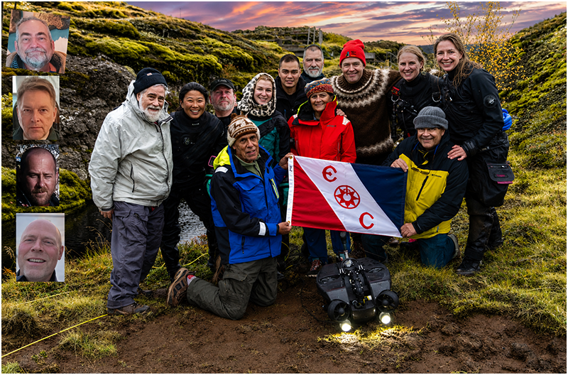
Iceland Expedition 2025 with Explorers Club Flag #249 next to Silfur Hellir Pool, Thingvellir National Park, Iceland. September 2025. Team Members, standing, Left to Right, back row: Steve Dicosola, Doris (Xuan Bu), Chris Nicola, Kyuu Ida Agata, Ágúst Daniel, Birgir “Biggi” Skulason, Sigurdur “Siggi” Johann Haraldsson, Dr. Hrefna Sylvia Sigurgeirsdottir, D.C., Yana Stashkevich.
Front Row, Left to right: Dr. Kenneth M. Kamler, M.D. (kneeling, holding Flag), Dr. Nasreen S. Haque, Ph.D. (standing), Bernie Chowdhury, (kneeling, holding Flag).
In front of Flag: DeepTrekker ROV.
INSERT, Top to Bottom: Bob Cohen, Kim Martin, Terry German, Erlendur “Elli” Gudmundsson.
Not shown: Johannes Thormodsson, Konrad Wisniewski
Honorary Members, Not Shown: Einar Asgeir Saemundsen, Dr. Leonardo Sturla Giampaoli, M.D., Árni B. Stefánsson, Malcolm Wengel. Copyright 2025, Stephen Dicosola
Whereas the 1997 Icelandic Cave Diving Expedition focused primarily on geology—with surveying and mapping as its central objectives—the Iceland Expedition 2025 was focused on biology, with remote mapping by Kim Martin serving as a continuation of what we had begun in 1997.
The objectives of the two Expeditions could hardly have been more different.
Yet some things remained unchanged.
Like its predecessor, the 2025 Expedition was granted an Explorers Club Flag. It was also the most ambitious exploration project I had undertaken to date.
The differences between the Expeditions extended far beyond their scientific focus.
The 2025 Expedition would involve more Team Members than any Expedition I had previously organized. It would also be both a diving and dry-caving project.
Adding to the logistical complexity was the fact that, at various times, Teams would be conducting different operations in different parts of Iceland simultaneously.
We would be searching underwater and underground for microbes that might one day contribute to the development of new medicines.
Microbes are living organisms too small to be seen with the naked eye. They require a microscope for observation, yet they represent one of the most important—and least understood—frontiers in biological exploration.
Our goal extended beyond simply finding microbes.
We also intended to investigate how microbial communities organize themselves within their environments.
In many ways, the concept is similar to how we study larger ecosystems. Just as different species occupy particular niches and relationships within a jungle, microbial communities also form patterns of organization that may reveal important information about the health of their environment.
One of the central questions we hoped to explore was whether microbial organization could serve as a reliable indicator of environmental integrity.
Could the structure of a microbial community reveal whether an environment was pristine, stressed, or in decline?
Using multifractal analysis, we hoped to assign numerical values to the degree of microbial organization or dysfunction present within a given habitat.
In theory, this would allow researchers to compare different environments quantitatively and determine the relative health—or degradation—of each location at the time of sampling.
It represented a fundamentally different way of examining ecosystems.
More importantly, it would require us to incorporate field methodologies that had never before been attempted under Expedition conditions.
Our Expedition scientist was a cellular and molecular biologist.
She is also my wife.
Dr. Nasreen S. Haque and I had long been involved in the search for microbes with potential medical applications.
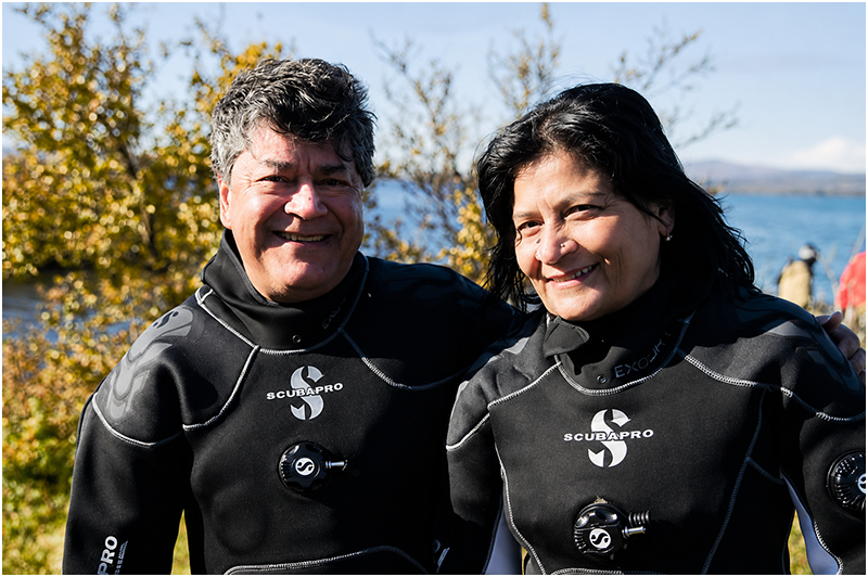
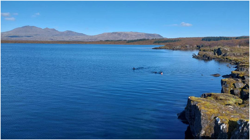
Iceland Expedition 2025: Bernie Chowdhury and Dr. Nasreen S. Haque, Ph.D., in dry suits lent by Siggi Haraldsson / Dive.Is for bio-sample collecting while snorkeling in Thingvallavatn, Iceland's largest lake. In spite of avascular necrosis in his left hip preventing him from safely scuba diving on this Explorers Club Flag Expedition, Bernie was able to get in the water with a little help from Siggi and the Icelandic divers. In the future, after hip replacement surgery, Bernie should be able to continue diving. "Ever Onward" became the Expedition's official motto after encountering -- and overcoming -- a litany of challenges, including the damaged hip. Copyright 2025, Stephen Dicosola
Bernie Chowdhury and Dr. Nasreen S Haque engaged in bio-sampling in Thingvallavatn while snorkeling, thanks to the suits lent by Siggi Haraldsson / Dive.IS. Copyright 2025, Stephen Dicosola.
Together, we had presented our research at numerous diving and scientific conferences, including the American Academy of Underwater Sciences (AAUS) Symposium in Key West in 2015. There, we presented a paper describing an inland dive site where we established a field laboratory and processed diver-collected bio-samples for analysis.
Advances in technology often transform what is possible during Expeditions.
One such advancement has been the miniaturization of analytical tools capable of identifying microorganisms in collected samples.
In the past, genetic sequencing could only be performed in fixed laboratories housed within traditional research facilities.
Today, handheld sequencing devices allow researchers to identify many microorganisms almost immediately, often before leaving the dive site itself.
It was a revolutionary development.
For explorers working in remote environments, it changed the rules entirely.
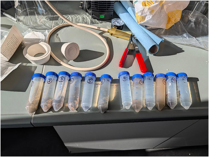
TEST TUBES: Bio-samples were collected in tubes, numbered, and documented. The primary goals of Iceland Expedition 2025 were to collect and analyze microbes to try and find things that may be useful in human medicine and also to determine the health of the environment by how the microbes aligned and interacted with one another, via multifractal analysis. Microbes are things too small to see without the use of a microscope. Copyright 2025, Bernie Chowdhury
Before leaving for Iceland, we were required to obtain government permission to collect bio-samples.
The application process required us to specify exactly where we intended to collect samples and which sites we planned to investigate.
Permission was granted quickly.
We received authorization to collect samples at every location we requested, including both underwater and dry cave systems.
One significant issue, however, remained unresolved.
It involved sampling within Thingvellir National Park.
The problem stemmed from the enormous number of diving and snorkeling tourists who came each year to experience the opportunity to dive between two continents.
As one might expect, with approximately 80,000 divers and snorkelers entering these waters annually—and with many of them experiencing water temperatures far colder than anything they had previously encountered—serious incidents were statistically inevitable.
And so they occurred.
Despite the presence of professional guides leading divers and snorkelers through the Silfra Rift, some visitors encountered problems beyond what any guide could reasonably be expected to manage successfully.
Following a number of fatalities within a relatively short period, diving activities at Thingvellir National Park were temporarily halted while authorities reviewed existing procedures and safety protocols.
A Committee was convened to analyze the accidents and make recommendations.
The process relied heavily upon accident analysis.
In many ways, it mirrored the work performed by the late American cave diver Sheck Exley during the late 1970s.
At that time, so many divers were dying in Florida's limestone cave systems that both state officials and private landowners threatened to shut cave diving down entirely.
Some landowners even discussed dynamiting cave entrances on their property.
Exley believed the accidents were neither random nor unavoidable.
Instead, he sought to identify common factors that repeatedly appeared in cave-diving fatalities.
His analysis led to the publication of Basic Cave Diving: A Blueprint for Survival in 1979.
The book remains in print today.
More importantly, it became the foundation upon which modern cave-diving training was built and, ultimately, influenced the development of technical-diving education worldwide.
During his investigation, Exley identified recurring patterns.
Cave divers who failed to use a continuous guideline to open water died at a significantly higher rate than those who did.
Cave divers who ventured to greater depths faced additional risks.
At the time, cave divers were breathing compressed air, and nitrogen narcosis played a role in many deep-diving fatalities.
By identifying common causes of accidents and developing practical safety rules, Exley helped dramatically reduce cave-diving deaths in Florida.
The Icelandic Committee reached its own conclusions.
Its recommendations ultimately became a legal Directive.
Divers would be restricted to a maximum depth of 60 feet (17 meters) within Thingvellir National Park.
No diving would be permitted beneath overhead environments, including caves, caverns, or even underwater ledges.
On Iceland Expedition 2025, bio-samples were collected at sites in open water, and in an underwater cave (with the use of a Remotely Operated Vehicle - ROV) and in dry caves. Copyright, Erlendur Gudmundsson
For our Expedition, the Directive created a major obstacle.
Although we possessed research permits authorizing bio-sample collection throughout the park, we were unable to obtain permission to dive inside Silfruhellir or to exceed the 60-foot / 17-meter depth limit anywhere within Thingvellir.
It did not matter that I had organized the 1997 Expedition responsible for surveying and mapping Iceland's most geologically significant underwater cave.
It did not matter that several Team Members were technical-diving instructors or retired technical-diving instructors.
It did not matter that our Expedition included a highly experienced physician serving as Expedition Doctor.
Nor did it matter that I had spent fourteen years working professionally in hyperbaric medicine.
The government remained firm.
The Directive existed because of previous accidents and fatalities, and researchers were not exempt.
No exceptions would be granted.
Of course, our divers could still collect bio-samples within Thingvellir National Park.
They simply could not do so below 60 feet / 17 meters or within underwater caves.
Fortunately, technology offered a solution.
A remotely operated vehicle (ROV) equipped with a grabber arm would allow us to collect samples from deep within Silfruhellir without placing a diver in the cave.
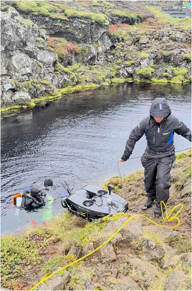
Deep Trekker Revolution Reconn ROV (Remotely Operated Vehicle). This tool allowed Iceland Expedition 2025 to collect bio-samples inside of Silfruhellir (formerly Silfur Hellir cave), an underwater cave that had been surveyed and mapped by the Icelandic Cave Dive Expedition in 1997. Since then, the Icelandic government has restricted any humans from entering underwater caves inside Thingvellir National Park, the site of Silfruhellir (formerly Silfur Hellir Cave), and the Silfra Rift. Copyright 2025, Bernie Chowdhury
The government approved that approach.
One unexpected benefit of using the ROV was the quality of the imagery we obtained.
The vehicle's powerful integrated lighting revealed details that had been impossible to capture during earlier explorations.
When my buddy first photographed Silfruhellir in 1995, much of the cave appeared simply black.
The ROV's lights told a different story.
They illuminated rich yellows and oranges within the lava rock, suggesting elevated concentrations of sulfur and iron.
For the first time, the cave revealed colors that had remained hidden in darkness for decades.
Iceland Expedition 2025 Team Member Ágúst Daniel prepares to deploy the ROV at Silfruhellir Pool. The ROV would film inside Silfruhellir and collect bio-samples from the cave. The Icelandic government now restricts any human diving inside underwater caves in Thingvellir National Park but allowed the research Expedition to use this remotely controlled robotic device. All bio-sampling was done with the express written permission of the Icelandic government. Copyright, 2025, Bernie Chowdhury
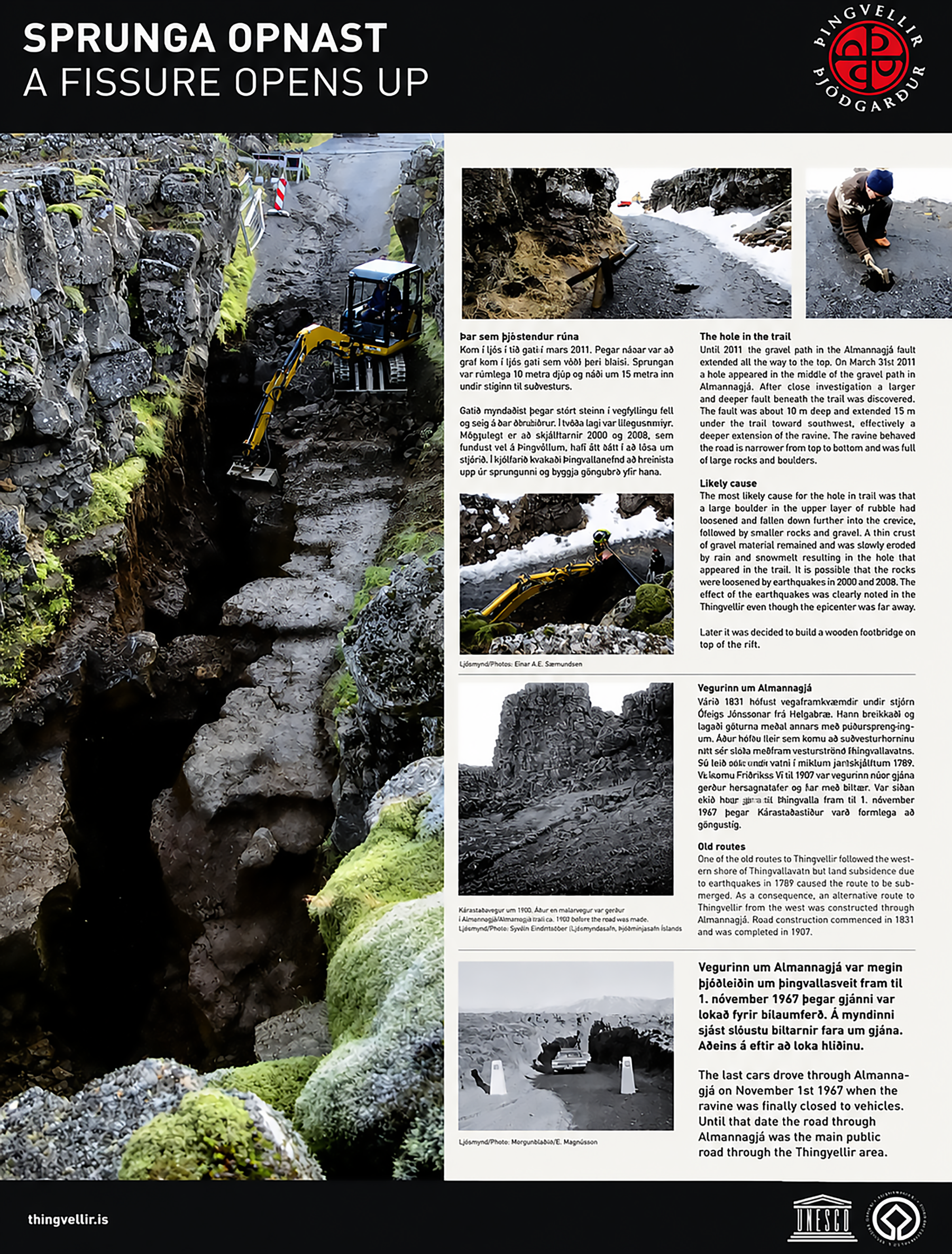
The hole in the trail
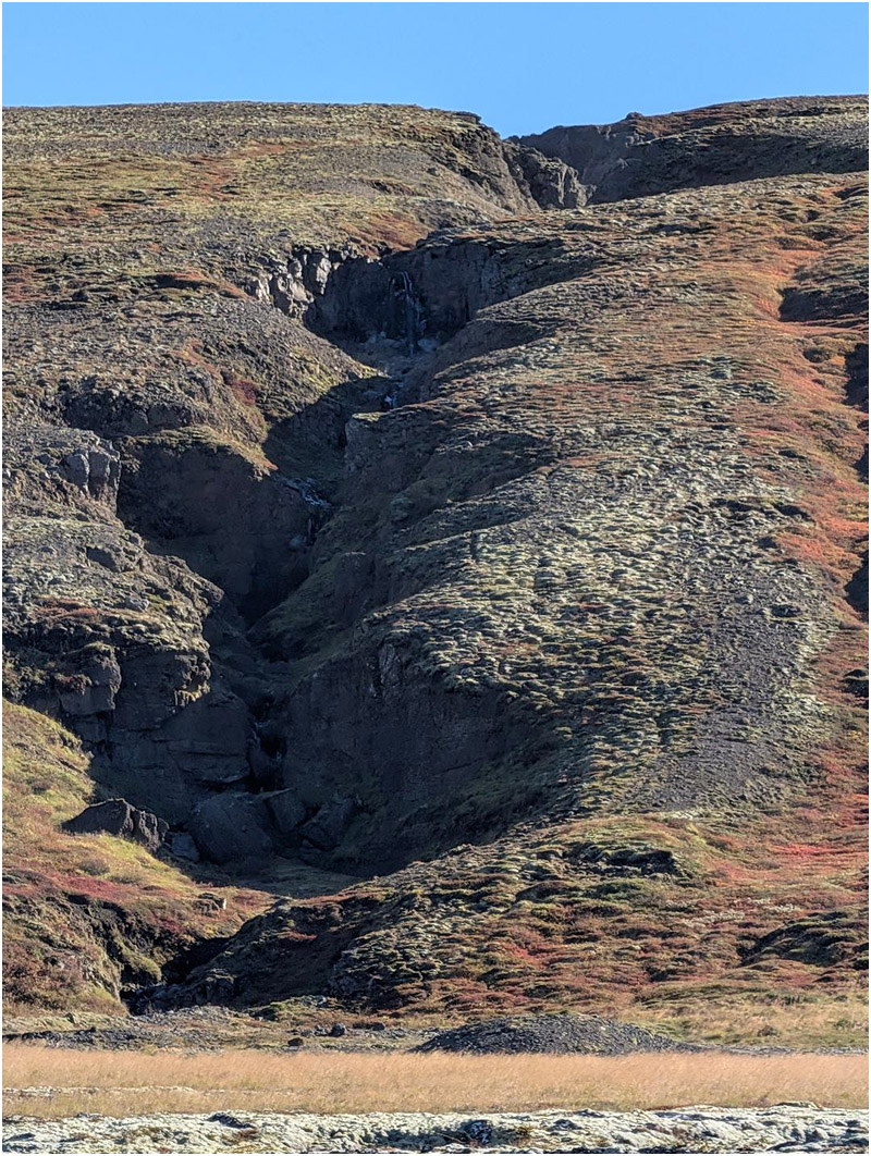
Until 2011 the gravel path in the Almannagjá fault extended all the way to the top. On March 31st 2011 a hole appeared in the middle of the gravel path in Almannagjá. After close investigation a larger and deeper fault beneath the trail was discovered. The fault was about 10 m deep and extended 15 m under the trail toward southwest, effectively a deeper extension of the ravine. The ravine behaved the road is narrower from top to bottom and was full of large rocks and boulders.
Likely cause
The most likely cause for the hole in trail was that a large boulder in the upper layer of rubble had loosened and fallen down further into the crevice, followed by smaller rocks and gravel. A thin crust of gravel material remained and was slowly eroded by rain and snowmelt resulting in the hole that appeared in the trail. It is possible that the rocks were loosened by earthquakes in 2000 and 2008. The effect of the earthquakes was clearly noted in the Thingvellir even though the epicenter was far away.
Later it was decided to build a wooden footbridge on top of the rift.
Old routes
One of the old routes to Thingvellir followed the western shore of Þingvallavatn but land subsidence due to earthquakes in 1789 caused the route to be submerged. As a consequence, an alternative route to Thingvellir from the west was constructed through Almannagjá. Road construction commenced in 1831 and was completed in 1907.
The last cars drove through Almannagjá on November 1st 1967 when the ravine was finally closed to vehicles. Until that date the road through Almannagjá was the main public road through the Thingvellir area.
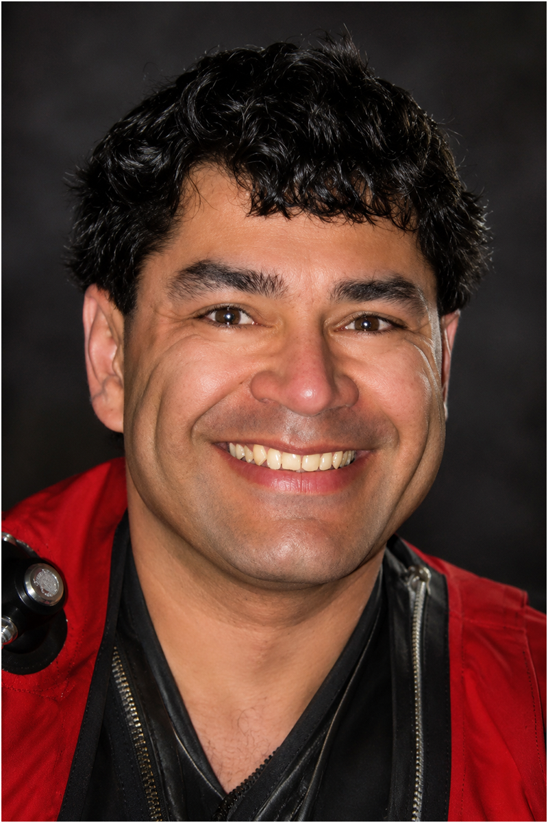
Bernie Chowdhury is the acclaimed author of The Last Dive (HarperCollins, 2000), one of the most influential books ever written about technical diving. Published in 11 languages, along with audio and large-print editions, the book has remained in continuous print for 26 years as of June 2026, becoming a modern classic in diving literature.
A Fellow of The Explorers Club since 1995, Chowdhury has carried the prestigious Explorers Club Flag on three expeditions—two to Iceland and one to India. Throughout his career, he has participated in pioneering expeditions involving historic shipwrecks, underwater cave exploration, and marine biology research.
For more than 14 years, Chowdhury worked in a variety of roles in hyperbaric medicine, combining his expertise in diving with the medical aspects of undersea exploration. He began diving in 1984 and became a certified diving instructor in 1988, teaching recreational, technical, and diving medicine courses to divers around the world.
His career spans exploration, education, medicine, and writing, making Bernie Chowdhury one of the most respected and influential figures in the history of technical diving.