|
|
|
Click on the below panoramic images to enlarge. (files are large and may take some time to open) |
|
|
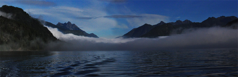 |
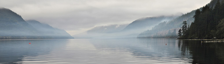
| Photo: Rugged Mountain, at 1860 meters, rises out of the mist to keep an eye on the “grease trail” that connects Nootka Sound to the east side of Vancouver Island. This trade route allowed relatively easy access by the Mowachaht\ Muchalaht First Nations people to trade goods with the Kwakwaka'wakw First Nation of northern Vancouver Island. |
|
|
|
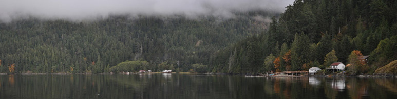 |
| Photo: The small white house with the red roof was originally the home of the Perry brothers who moved to this site in the Tahsis Narrows when their homestead at the mouth of the Leiner River “became too crowded” when the Tahsis sawmill was built in 1947. The buildings in the centre of the photo are the old Canadian Packing Corporation pilchard cannery built in 1926. |
|
|
|
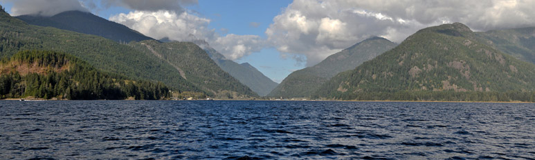 |
| Photo: Looking north up the Tahsis River valley, as Rugged Mountain hides her face in the clouds, the ridge on the right is the beginning of the rugged Maquinna Trail. This trail was immortalized in the book “White Slaves of Maquinna” as the place where Chief Maquinna spent much of his time. |
|
|
|
 |
| Photo: As we head out for another day of diving the wood smoke from burning logging debris filters down to sea level and is gently blown to seaward. |
|
|
|
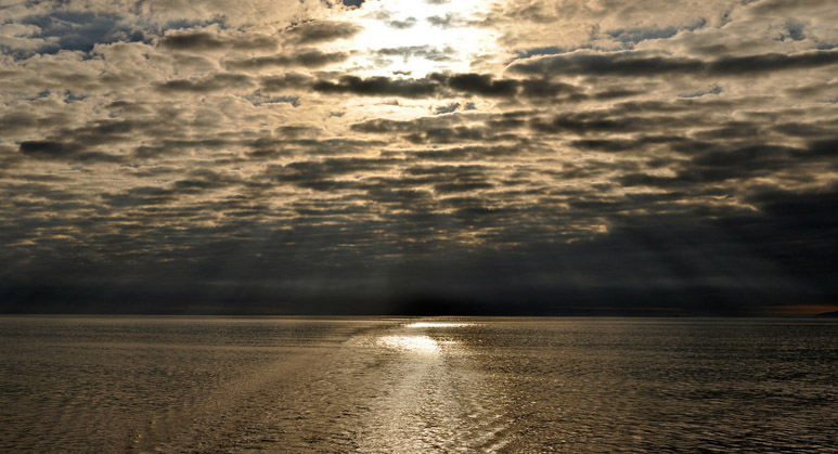 |
| Photo: A dappled sky with menacing clouds low on the horizon. Hidden in the clouds is Center Island- next stop, probably Japan. |
|
|
|
 |
| Photo: Storm damage to the breakwater that protects the Maquinna Marina from heavy weather. The dozer boat that is tied to the breakwater is used for log boom work and barge loading. |
|
|
|
 |
| Photo: Garden Point, a rocky point that hides behind Center Island can be wind blown and desolate but the number of fish under the point make you think you're diving in an aquarium. If you keep an eye over your shoulder you'll probably see one of the many sea lions that cruise the area. |
|
|
|
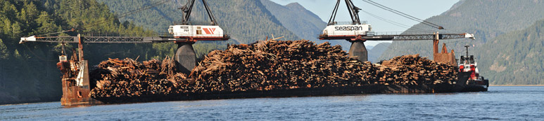 |
Photo: With the slow forest industry in the area sights like this are uncommon. This deep sea tug and barge, the Seaspan Regent and Seaspan Phoenix, have taken on a load of pulp wood destined for one of the pulp mills on the coast. The bundles of logs that are loaded on board can weigh as much 50 tons. The dozer boat that is being loaded on the stern is one of three that are carried on the barge.
|
|
|
|
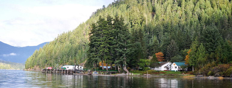 |
| Photo: Tlay Maak tsu is the name of the historic site approximately six miles west of Tahsis that the Ehattesaht people of the Nuu chahnulth First Nation used as a resting and stop over place for canoeing travelers. The village is ideally situated; it has easy access from the ocean, cool refreshing potable water and protection from the prevailing winds. It is this exact location that, in 1937, Dr. Herman Mclean, with the aid of Percy Wills and Mr. Peters from the Ucluelet Tribe, were led. This location became known as Esperanza. No longer a medical mission, Esperanza, its staff and volunteers, remain steadfast to the calling of community, refuge and service. |
|
|
|
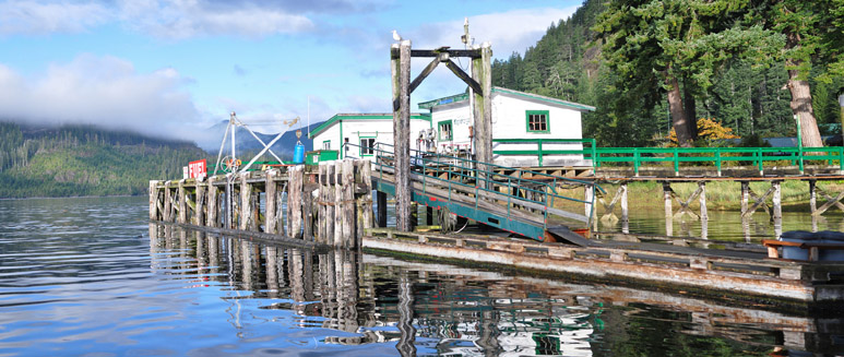 |
Photo: Esperanza's fuel dock and store. Always a pleasant place to stop for fuel, water, or a bit of a history lesson on the area. The people that you meet here are some of the nicest you will find on the coast.
|
|
|
|
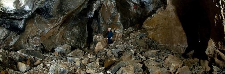 |
| Photo: Vancouver Island local dry cave expert Martin Davis poses within one of the many large cave chambers located within the mountains surrounding Tahsis. |
|
|
|
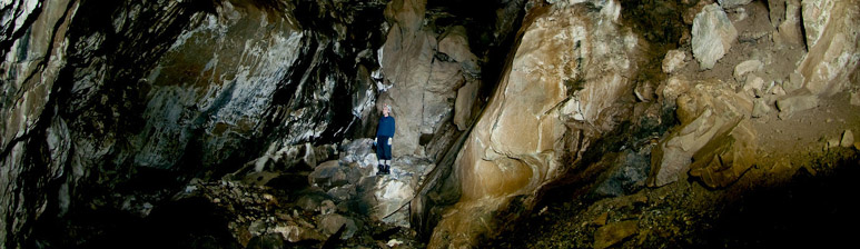 |
| Photo: Martin Davis, Vancouver Island local dry cave expert poses within one of the many large cave chambers located within the mountains surrounding Tahsis. Curt Bowen paints a 30 second time laps image of the amazing chamber. |
|
|
|
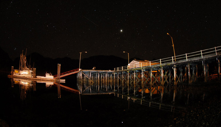 |
| Photo: The planet Jupiter shines brightest amongst a billion twinkling stars. Mirrored reflections of the Tahsis city dock create a floating illusion of outstanding beauty. Standing below the vastness of the nights sky, creates an awareness of the true immensity surrounding you. |
|
|